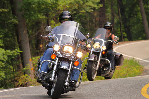
Tuesday night I spent in the town of Crossville, TN. Wednesday morning greeted me with another warm morning, so the leather vest was packed away for the day ... too hot to look cool! hahaha!!!
After posting the previous blog, I mapped out a plan to make my way to Look Out Mountain on the border of Georgia and Tennessee to do the tourist thing. (Or should I say "thang" now that I am down south?) The ride through Tennessee was very pretty. Not nearly the winding roads like Kentucky, but beautiful scenery for most of the way. Running south on 127 and Tennessee Route 8, I was flanked by
 |
| The scenic views on Tennessee sections of US Route 127 & TN route 8 |
buttes on either side, with groves of trees or fields of corn and other crops between them and the highway. The heat kicked up to 103 about mid day as I crossed the Tennessee River in Haletown on Route 41 heading east. There were loaded barges in the river inching their way along to my left as I crossed. Unfortunately, there are always "No Stopping" signs on the bridges where the best pictures are begging to be shot! The highway followed the east banks of the river from there, and like all river roads, meandered up and down with ample tree shade to give me a welcome break from the sun. This route brought me
 |
| There are all kinds of photo ops there |
into the south side of Chattanooga, which is the gateway to Look Out Mountain. A steep, winding road leads up there from either side and you get the feel of how touristy the place is when there is somebody in the parking lot directing traffic in 103 degree heat. After parking and changing from boots to tennis shoes for the visit, I about choked at the $21 fee for entrance!
Also known as Rock City, the Look Out Mountain park was opened to the public around 1932, after the property owner's realized that the pathways they had created in their garden could be a great roadside attraction. The original owner's wife was fascinated with fairies and gnomes, and the place has multiple little gnomes statues throughout the walking tour. Granted, the work of creating the pathways and bridges on the property was certainly an admirable feat, but the execution and presentation of the place over all is the true definition of tacky with a capital "T". From the minute you start the tour, you notice the background sound of soft music, mixed with birds singing (on the sound track with the music), which adds to the puke value. Then there are all these stupid gnomes throughout

the place, including caves with little gnome settings of villages and working gnomes and glow in the dark gnomes. It's just freaky. I will admit that the kids and the foreigners walking the tour seemed to love it. And if nothing else, it was worth it to see the rock formations and the view from the top. What appears to be a spectacular water fall is man made and there is a pitiful "deer park" where I saw one deer hiding beneath a bridge in a very sad enclosure. There is a swinging bridge, which is pretty cool too. If this park was built today, it would be far different. All of the stone walls were far beneath building code requirements and I can't believe kids don't go over them every so often. I mean, many of the walls over bridges were not more than a couple feet high. Would I go again? No. Would I recommend a visit? Sure. That's why they call them roadside attractions.
 |
| This was called Fat Man's Squeeze |

By the time I was sliding my riding boots back on, it was going on 2pm EST and I needed to head west back towards Decatur, Alabama to visit with Buffalo's cousin Kimmie and her husband, Gary. I looked at the maps and decided that if I headed right at the bottom of the mountain it would run me to my desired highway. I followed that highway to another one, did a map check and followed that one to what I thought was US route 75 in Alabama. Turns out I had once again temporarily misplaced myself. Fortunately, an intersection with another route and a quick map check sent me in the right direction. According to the trusty Rand McNally, route 75 is marked scenic (little green dots along the highway on the map designate this) but the only thing scenic about it was that it seemed to exemplify the stereotype of what the movies make you think Alabama is! Sad looking mobile homes, piles of junk cars and miscellaneous yard stuff littered most of the properties for a fair amount of the way. I found nothing scenic about that road at all ... as a matter of fact, I would say that it was the most disappointing two lane on the trip so far. I
caught 205 in Albertville to Guntersville, where 205 abruptly

ended at a highway with no signs! Had to stop to ask what it was! I eventually made it to Decatur but had to call Kimmie for
directions to her house as I wrote them down wrong that morning when I Google Mapped her. Gary and Kimmie treated me to a great dinner of shrimp, corn on the cob, sausage and potatoes, followed by a lively conversation to finish up the evening.
Wednesday is a rest day for me and the scooter. Did some laundry and washing the bike, lunch out with Kimmie and I am promised an evening motorcycle ride with Gary and Kimmie tonight. Life is good. I will finish up with some more pictures.
Peace! Bobbi
 |
| I braved this bridge, which for me, is saying a lot! It was called Swinging Bridge for a reason. |
 |
| One of the many caves. There was either light at the end coming in or they had some very dim lights inside. |
 |
| According to Wikipedia, this has never been proven. It was claimed by officers during the civil war and became folk lore. |
 |
| the top view is called Lover's Leap. The lower view was built for photo ops I believe. | |
 |
| Doing the tourist photo op thang! |


 By the time I was sliding my riding boots back on, it was going on 2pm EST and I needed to head west back towards Decatur, Alabama to visit with Buffalo's cousin Kimmie and her husband, Gary. I looked at the maps and decided that if I headed right at the bottom of the mountain it would run me to my desired highway. I followed that highway to another one, did a map check and followed that one to what I thought was US route 75 in Alabama. Turns out I had once again temporarily misplaced myself. Fortunately, an intersection with another route and a quick map check sent me in the right direction. According to the trusty Rand McNally, route 75 is marked scenic (little green dots along the highway on the map designate this) but the only thing scenic about it was that it seemed to exemplify the stereotype of what the movies make you think Alabama is! Sad looking mobile homes, piles of junk cars and miscellaneous yard stuff littered most of the properties for a fair amount of the way. I found nothing scenic about that road at all ... as a matter of fact, I would say that it was the most disappointing two lane on the trip so far. I
 ended at a highway with no signs! Had to stop to ask what it was! I eventually made it to Decatur but had to call Kimmie for


2 comments:
You would love Cloudland Canyon up there.
Jeff Nichols, I will be back next summer! I loved it down there. Soooo much to see! Not enough time. Save me a spot by that fire and the lake my friend.
Post a Comment